Have you ever wanted to "time travel," going back to an old location to see how it has changed? With Google Maps, this is entirely possible! With just a few simple steps, you can view old images of your childhood home, a memorable street, or any place you desire.
In this article, YutoIT will guide you step-by-step on how to do this on both computer and mobile devices.
Viewing Old Photos on Google Maps Using a Computer
Access Google Maps: Open your web browser and go to the Google Maps website:
https://www.google.com/maps
Switch to Street View Mode:
https://www.google.com/maps
Switch to Street View Mode:
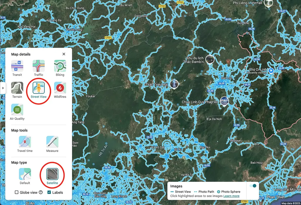
- In the bottom left corner of the screen, select the "Map Layers" (Layer) icon
- Click on "More"
- Enable "Street View" mode and "Satellite" view
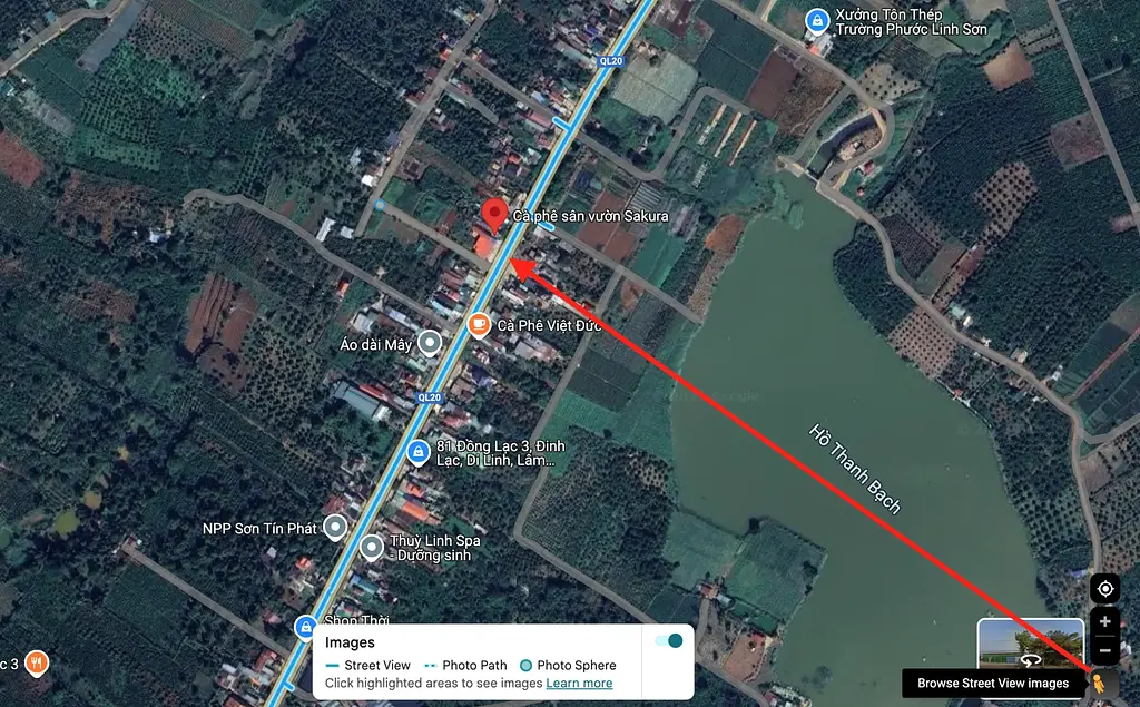
- Drag and drop the yellow person icon to the location you want to see on the map
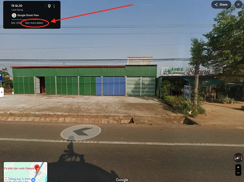
- In the top left corner, you’ll see a small information box. Click on the text "See other dates"
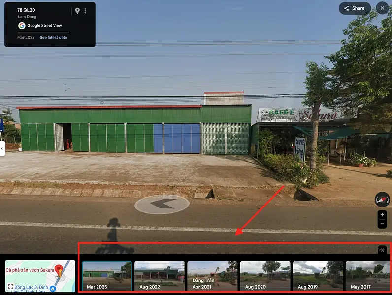
- A time slider will appear, allowing you to select different years to see how the location has changed
Viewing Old Photos on Google Maps Using a Mobile Device
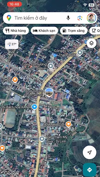
Open the Google Maps App: Make sure you have the Google Maps app installed on your phone
Enable Street View Mode:
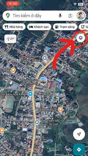
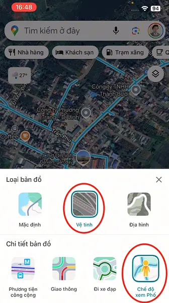
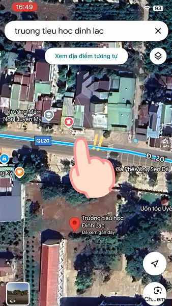
- Tap the map layers icon in the top right corner
- Select the map type as "Satellite" and map details as "Street View"
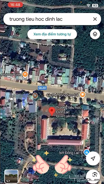
Search for a Location: Enter the address you want to view
View Old Images:
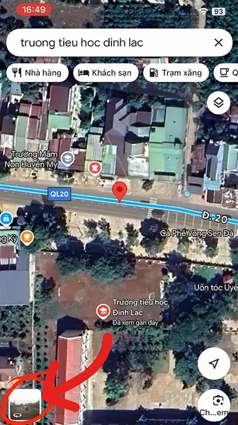
- Use two fingers to zoom in on the map, then press and hold on the street you want to view to pin the location
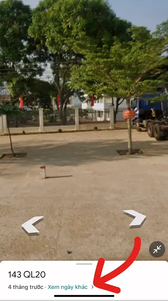
- A small image of the location will appear in the bottom left corner; tap it to enter Street View mode
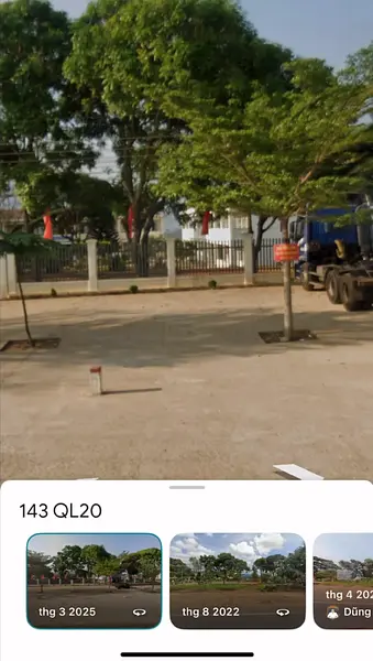
- Select "See other dates" at the bottom of the screen to view older time periods
Additional Information
- Old image data for Vietnam on Google Maps is generally available from 2017 onwards
- Major roads and highways often have more historical data compared to smaller roads or rural paths
Wishing you an exciting experience as you "time travel" with Google Maps!


